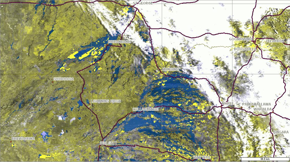
Landgate's FloodMap service has captured, via satellite, the extensive flooding in Queensland this morning.

This data was collected at 10:09am (WST) from the MODIS Terra sensor (satellite). Cloud cover persists over St George however substantial flood water, depicted as blue, is evident. Land is depicted as yellow, and cloud as white.

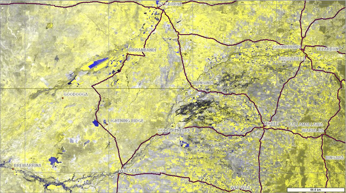
In comparison, this second image is of the same area from 3 January 2012 8:00am (WST) and shows dry plains, highlighting the extent of current flooding.
Landgate's FloodMap service collects surface water information across Australia daily at 250m spatial resolution, subject to cloud cover. FloodMap is available for public viewing.
The webpage also delivers other related information that is generated from this surface water information, including an Australian flood hazard map.