What is included?
Road centreline data gives you:
- proposed road segment
- road junction
- road segment.
The layers within the service are updated weekly and it provides a comprehensive depiction of the state’s road and tracks system. All named segments link to Landgate’s Geonoma Database.
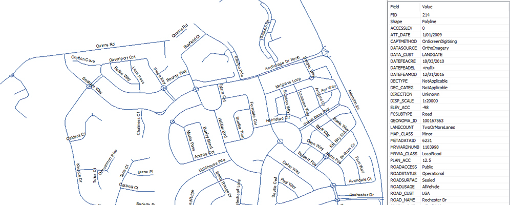
| Key information and attributes | |
| Road name, date of capture, map classification, lane count, direction category, proposed roads, tracks, major roads, minor roads, highways, simplified roads, excludes DBCA restricted roads. | |
| Geometry type | Line |
| Supply format | GeoDatabase, Shape File, GeoPackage, DXF, SLIP - Web Services, API's and Data Downloads |
| Update cycle | Weekly |
| Coverage | Whole of state |
| Data download | Yes |
| Accuracy | N/A |
Data dictionaries
How to access our road centreline data
Access options
Request a one-time extract of the latest version of this dataset in a format that suits you.
If you wish to receive data supplied on a regular basis, please email CustomerExperience@Landgate.wa.gov.au
| Data Theme | 1-50 | 51-500 | 501-5000 | Over 5001 |
| Road centreline | $2.83 per 10 features | $1.41 per 10 features | $0.71 per 10 features | $0.36 per 10 features |
Digital data extracts are subject to extraction and data costs. The extraction cost is $213.40 per hour, with a 1.5 hour minimum ($320.10). Additional charges may apply. Please complete and return a request form for a formal quote
Please see Licensing for conditions of use.
Access much of our location information datasets 24/7 for as many of your team as required with our Shared Location Information Platform (SLIP). Find out if this platform is right for you.
Go to SLIP subscription services
Subscribe to SLIP
Enter into a business agreement with Landgate and become a value-added reseller. Find out how to get started.
Need help?
You can contact our Customer Experience team on +61 (08)9273 7683 or email CustomerExperience@Landgate.wa.gov.au for more information on our data and SLIP subscription services.