What is included?
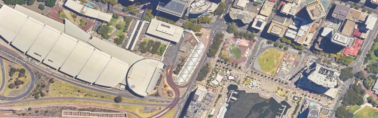
All of our aerial imagery is visible spectrum and corrected to allow for distortions caused by the curvature of the earth’s surface, relief and any lens aberrations.
Aerial imagery data can be accessed by:
- ordering a bespoke extract through our Location Information transaction form
- purchasing an extract online through MapViewer Plus or
- signing up to a SLIP subscription service
Explore our aerial imagery subscription services
If you opt to sign up to a SLIP subscription service, you will need to choose from one or more of the imagery options below, depending upon your organisation’s requirements.
WA Now
This base layer imagery is a whole of state layer, configured as a flattened and seamless single service. It can be used as a background in conjunction with other data services to provide a spatial reference and contains the most current 1:100,000 aerial imagery tiles, aboriginal community, regional, and town site mosaics.
Perth Metro
The Perth Metro service has recently combined Perth’s bi-annual capture (Perth2) and quarterly capture (Perth4) imagery services into a single service. It provides Perth metropolitan aerial imagery as individual mosaics from 1947 through to the present day.
Perth was captured annually until 2010, became bi-annual in 2011 and then quarterly in 2015, reverting to a bi-annual program in 2018. Imagery captured prior to 2007 has been converted from individual, analogue frames to seamless digital orthorectified mosaics. The scan resolution equates to approximately 20cm GSD.
The ground resolution of our digitally captured imagery varies between 10 and 15cm GSD.
NB: not all imagery captured prior to 2000 is currently available in this service; it is being added progressively over time and made available at no additional cost to the subscriber.
WA Regional
This service provides access to all available regional imagery as separate layers from 1987 to the current year. This includes the most current 1:100,000 aerial imagery tiles, aboriginal community, regional, and town site mosaics.
| Key information and attributes | |||
| Supply format | Raster | ||
| Coverage | Whole of state (excluding East Arid) | ||
| Data download | No | ||
| Colour | Imagery prior to 1980 will be black and white | ||
| Completeness | Some imagery captured earlier than 2000 is not available within these services and will be added progressively over time at no additional cost. | ||
| Horizontal accuracies: | |||
| Imagery | Prior1980 | 1981-2010 | 2010- current |
| Metropolitan Perth, town sites, aboriginal communities (x≤15cm) | ±2.5m | ±1m | ±0.5m |
| 1:100k Regional mosaics (15cm≤x≤50cm) | ±10m | ±2m | ±1m |
Guidelines for access to aerial imagery for value added resellers
Due to the nature of aerial imagery and the market for its supply, usage must be acceptable to Landgate and specified within a licence before access and pricing is provided.
Acceptable use
- Generally, Landgate will allow access to imagery where it will not be used as the primary focus of a derived product. Where the focal point of a VAR’s product is in providing functionality, information or a solution to a problem and aerial imagery is merely providing a supplementary visual reference/backdrop, it will be considered favourably.
Unacceptable use
- Where the selling point of a VAR’s product is the actual aerial imagery, with added functionality considered secondary or an enhancement to the imagery, then Landgate will not provide imagery access.
- Where a VAR creates a product that will have users frequently consuming large amounts of imagery (within the SLIP environment), resulting in degraded performance for other subscribers. In these instances, Landgate may look to provide the imagery via an alternative channel.
Request a on-time extract to the latest version of this dataset in a format that suits you.
If you wish to receive data supplied on a regular basis, please email Businesssolutions@landgate.wa.gov.au
OR
View and purchase aerial imagery online using Map Viewer Plus and get access to your imagery faster.
What you need to order:
- a property street address or select an area of interest
- debit or credit card
- email address
Access much of our location information datasets 24/7 for as many of your team as required with our Shared Location Information Platform (SLIP). Find out if this platform is right for you.
Go to the SLIP subscription services:
Subscribe to SLIP
Enter into a business agreement with Landgate and become a value-added reseller. Find out how to get started.